Burgundy Wine Geology: Limestone, Marl and the Fault
Simon Stoll
Oenosuite Founder
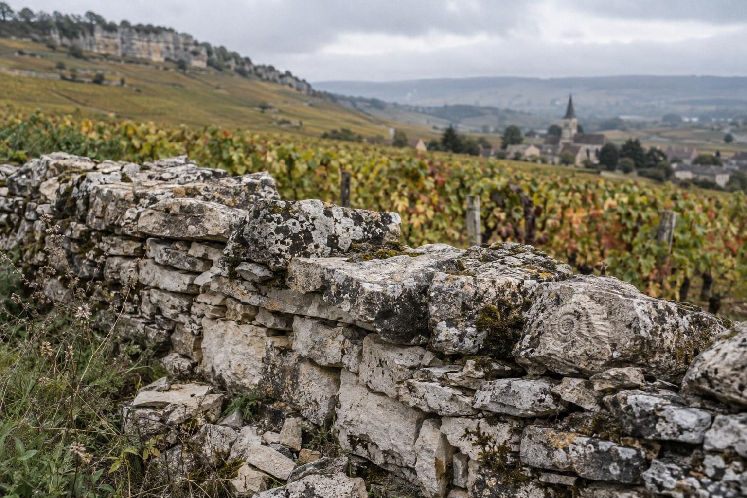
The geology of Burgundy wines fits in one image: a Jurassic tropical sea floor, some 200 million years old according to the sources, lifted and broken by a north-south fault when the Alps formed about 30 million years ago. The result is the Côte d'Or, a limestone slope running from Dijon to the Dheune valley, facing the Saône plain. Understanding this limestone and marl bedrock explains why two neighbouring plots give different wines, and why Burgundy learned to name them climat by climat.
A warm, shallow sea 200 million years ago
In the Jurassic, the region lay under a warm, shallow tropical sea. The skeletons and shells of countless marine organisms piled up on the bottom and formed limestone sediments, alternating with clay-rich layers called marls. Over millions of years, several hundred metres of sediment compacted into rock. This alternation of hard banks and soft layers explains the patchwork of soils you cross when walking through the vines, often changing within a few dozen metres.
These rocks are not all alike. Among the Middle Jurassic formations are the crinoidal limestone (calcaire à entroques) of the Bajocian, a rock made of crinoid fragments whose many fractures store water beneath thin soils, and the very hard Comblanchien limestone. Higher in the series, the Oxfordian marls, richer in clay, hold more moisture. Dating varies between authors, from 150 to 200 million years: the point is that the vine sends its roots into layers of very different ages and hardness.
The fault: how the slope was born
About 30 million years ago, the rise of the Alps caused, in the Oligocene, the collapse of the Bresse basin along north-south faults. The raised edge of this great staircase is the côte: an escarpment with an average drop of about 200 metres according to a study of wine geography, cut by valleys called combes. The slopes face east, towards the morning sun, and overlook the younger alluvial deposits of the Saône plain, where the most basic appellations are grown.
This fracture is not alone: secondary faults put layers of different ages side by side. In the south of the Côte de Beaune, the great Montrachet fault and the Santenay fault bundle diversify the terrain further. A geologist would call Burgundy a puzzle; a winemaker would say that this is the reason for the climats, the plots delimited over the centuries, listed together as a UNESCO World Heritage site since 2015.
Côte de Nuits and Côte de Beaune: hard limestone, soft marl
A useful generalisation, to be handled with care: the hard Bajocian and Bathonian limestones are found mostly in the Côte de Nuits, Pinot Noir country, while Oxfordian marls, associated with great Chardonnay whites, dominate in the Côte de Beaune. Reality is subtler, since each village mixes both, but the rule helps explain style: tightly structured reds to the north, broader whites on the marly soils to the south.
Between Nuits-Saint-Georges and Chassagne-Montrachet, some geographers speak of a "Côte des Pierres": the hard Premeaux and Comblanchien limestones outcrop there and slide down the slopes. Comblanchien limestone is even quarried as building stone, sometimes called marble, in quarries in the communes of Comblanchien and Corgoloin. The walls, cellars and churches of the region are therefore made of the very rock that feeds the vines.
What soil gives a wine comes through drainage, water reserve and vine nutrition. On thin, fractured soil the vine digs deep and grapes stay concentrated; on marly soil water stays available longer, which often gives broader wines. No geology explains a wine on its own, though: exposure, altitude, vintage and above all the winemaker's hand count just as much. The soil proposes, the winemaker disposes. That is also why tasting side by side, with the same grape from two different bedrocks, remains the most honest geology lesson Burgundy can offer a curious visitor, far more convincing than any diagram or textbook explanation.
Reading this landscape on the ground, from Dijon
To see this geology for yourself, you need no degree. Drive along the Route des Grands Crus and watch for the break of slope of the côte, the combes cutting into it, the white-stone quarries near Comblanchien, the dry-stone walls around the clos. A Côte de Beaune white followed by a Côte de Nuits red is worth any geological map: you taste the soil difference before you understand it. Stop at a combe or a roadside quarry, look at the colour of the stone in the walls, and compare it with the pale rubble between the rows: the story told in the previous sections suddenly becomes visible, concrete and easy to remember.
The Cité des Climats et vins de Bourgogne in Beaune offers exhibitions and workshops that place these ideas in the landscape, and is a good first stop before heading into the vineyards. For a first reading of the landscape, the Côte de Nuits can be covered in one day from Dijon, and the drive between the two côtes gives an immediate sense of changing rock, from pale stone to browner soils.
To extend the discovery, the simplest base is the heart of Dijon: Oenosuite, the only apartment labelled Vignobles & Découvertes in Bourgogne-Franche-Comté, is steps from the Palais des Ducs, with the Route des Grands Crus 20 minutes away. The Jalunia connected cellar, self-service from the suite, lets you compare Côte de Nuits and Côte de Beaune wines when you get back; book direct on oenosuite.fr or on +33 7 50 96 09 18. And to give this trip to someone curious about terroir, the Oenosuite gift card leaves the dates open: you set the amount, from €25 to €1,000, and they choose their weekend within 12 months.
Sources & references
Plan your trip to Burgundy
Book your wine accommodation in Dijon
Luxury wine suite with complimentary blackcurrant liqueur, Jalunia connected cellar and wine tourism experiences.
Book now